


C-MAP Boating

Perihal C-MAP Boating
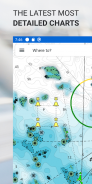
Apl C-MAP® ialah teman yang sempurna untuk pengembara rekreasi dan pencinta air. Tersedia pada Mudah Alih, Tablet atau PC, anda sentiasa boleh mengakses carta C-MAP yang paling terkini, di mana-mana sahaja di dunia anda berada.
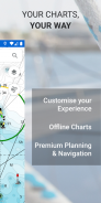
Dengan ciri penuh, membolehkan anda meneroka, merancang dan menyimpan Tempat Menarik dan Laluan dari mana-mana sahaja anda berada, Apl C-MAP ialah bantuan terbaik untuk navigasi untuk pelayar yang bijak.
Apl C-MAP Termasuk:
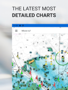
- Pemapar Carta PERCUMA
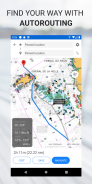
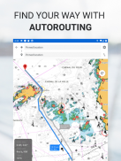
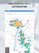
- Autorouting™ – cari laluan terbaik ke tempat kegemaran anda
- Titik Jalan Peribadi
- Rakaman Trek
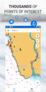
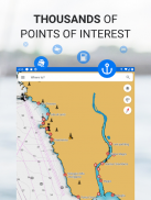
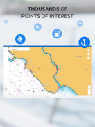
- Beribu-ribu Tempat Menarik yang dipramuat
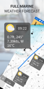
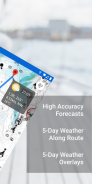
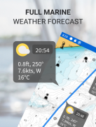
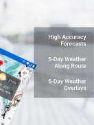
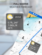
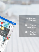
- Ramalan Cuaca Marin
- Cuaca Sepanjang Laluan
- Tindanan Cuaca
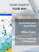
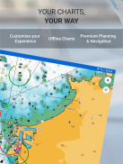
- Pemperibadian Carta
- Import & Eksport Fail GPX – kongsi Laluan, Laluan atau Titik Jalan anda dengan rakan
- Alat Ukur Jarak
Tingkatkan kepada Premium untuk membuka kunci ciri tambahan, termasuk:
- Fungsi GPS Penuh
- Muat Turun Peta Luar Talian
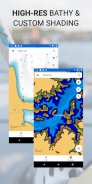
- DEDAHKAN Pelepasan Berlorek
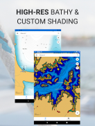
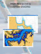
- Batimetri Resolusi Tinggi
- Teduhan Kedalaman Tersuai
- Trafik AIS & C-MAP
Cuba sebelum anda membeli… Alami sendiri C-MAP App Premium, dengan percubaan 14 hari percuma.
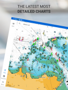
Apl C-MAP dikemas kini secara berterusan, memastikan peta terkini dan paling terkini sentiasa berada di hujung jari anda.
Dasar Privasi:
https://appchart.c-map.com/privacy.html
Syarat Perkhidmatan
https://appchart.c-map.com/tos.html
C-MAP Boating - Versi 4.5.2
(10-04-2025)
C-MAP Boating - Maklumat APK
Versi APK: 4.5.2Pakej: com.isea.EmbarkVersi Terkini C-MAP Boating
Versi lain


 4.15
4.15


Aplikasi dalam kategori sama


